Monday, August 31, 2009

Broome

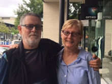
Broome had been a relaxing break however working the tides to get ashore in the dinghy has been a challenge. We were anchored 1 mile off shore so it was usually a very wet ride home into the westerley afternoon sea breeze. Broome is a tourist town with many interesting shops and restaurants as well as the rich history surrounding the pearl industry. Cable Beach lives up to its reputation with a long sandy beach and many resorts and restaurants along the high sand dunes looking out over the "azure" blue of the Indian Ocean. We were fortunate to have friends in town who lent us their car, a big help with boat shopping and reprovioning for the trip south. We also managed a trip to the dump to remove a "few" empty wine bottles from the trip from Darwin!!


While in Broome our friends Nick and Kat announced their engagement. They joined us for a lovely day on the water on Sunday with their friend Sarah. We motored around to Cable Beach, with the fishing lures out but no luck. Tried a bit of fishing at the reef then anchored just off the beach for a swim and lunch. The beach was covered in 4WD vehicles, the occupants enjoying the beautiful weather. We then had a good sail back to Roebuck Bay and nearly lost the lure to a large mackerel - however it was one the ones that got away, such a shame for Nick who is a keen fisherman.


The Sea Princess was in Broome for the day - it is a large inernational cruise ship and was quite a site at the wharf. We are currently sailing out of Broome heading south to Dampier. We will be sailing non stop for the next few days as there are not many anchorages of this stretch of the coast.

Raft Point to Broome


Hi to all our family and friends, we arrived in Broome late Wednesday 26 Aug, after a 16 hour journey from Beagle Bay on the West Coast of WA. We have TV reception again so were able to watch an episode of "The Cook and the Chef" while enjoying a well earned glass or two of wine.


Our last update had us underway to Raft Point. This area has a long Aboriginal history associated with initiation ceremonies on Steep Island, located opposite at the point at the entrance to Doubtful Bay. Raft Point gained its name from the launching of rafts to fish for Dugong, Turtle and also to send food across to Steep Island where the young men stayed during their rites of initiation. In the caves high up on the Point a series of rock art galleries are accessible after a walk up the hill. The paintings are of the large Dugong, Turtle, crocodiles and fish that were hunted as well as some more of the Wandjina art. The cave floor and walls are coated in soot from cooking fires as well as remnants of stone tools and shells.


Later in the day we smoked some Mackerel which we enjoyed for dinner. We spent two nights here, a good opportunity to catch up on the washing, and take some time out to enjoy our spectacular surroundings of sheer red cliffs, rocky islets and and the vista of Doubtful Bay across which a few of the large tourist charter boats travelled each day.


Our friends, Peter and Susan had planned to fly out from Cockatoo Island and when confirming their flight found that a change of departure point was required. The best option was to head to One Arm Point on the eastern side of the Dampier Peninsular. On Thursday 20 August we sailed/motored across the top of Collier Bay, past Koolan Island and Cockatoo Island. These islands have large iron ore mines carved out of the steep rock hillsides which fall precipitously to the shores below. It was fascinating to see the large mining trucks winding their way up and down the hillside.


We selected Myridi Inlet as our overnight stop however while looking for a spot to drop the anchor we ran aground on a sand bank. Luckily we were able to reverse off and anchor near a charter boat - providing some entertainment for their guests who were enjoying sundowners on the top deck as we came to a sudden holt. Cran philosophized that, if you are going to do something like that, it will always happen when you have an audience! The bottom went from over 10m deep to less than 1m on a verical wall. Luckly the top of the wall was sand/mud so no damage to the boat, just the skipper's pride.


The following morning we left early in order to work the tides to cross the top of King Sound. We motored through narrow straits with whirlpools and eddies, across strong current lines, zigzagging around the many islands in the Buccaneer Archipelago, finally passing to the south of the Sunday Islands. The islands at the top of King Sound have a low profile and are very weathered with sparse vegetation. We were heading for Catamaran Bay part of Cygnet Bay however at we approached the anchorage we could see a large pearl farm operation in the bay. A call then a personal visit from the owners of the farm advised us to anchor around at Shenton Bluff which proved to be a delightful anchorage and a short dinghy ride to the beach near the end of the air strip at One Arm Point. We enjoyed a celebratory champagne and dinner with our friends Peter and Susan, who were leaving us the following day. The past four weeks had passed quickly and we have covered 810 Nautical Miles since leaving Darwin, seeing much that the Kimberley has to offer. The vastness of the area is not easy to comprehend. We have met people who have cruised here for many years and still have new places to explore. We have been fortunate to see as much as we have and to be able to share this memorable experience with good friends.


On Saturday 22nd August Peter and Susan treated us to a scenic flight from One Arm Point over the Sound and Talbot Bay. We were able to view the area we had sailed through over the previous two days. From the air the vast folded landscape of the western end of the King Leopold Ranges and the many islands in King Sound spread out before us. We could see the movement of water in the sound as it raced past the islands on the outgoing tide. The highlight of the flight was to see the Horizontal Waterfalls from the air. The falls are two narrow gaps between vertical sandstone rock walls which are the entrance to two bays. As the tide rises and falls the water inside the bays rushes in or out with up to 10 metre tidal range causing height differences between the inner bays and the outer bays forming the waterfalls of whirlpools and raging currents as the water pours through. An amazing sight.After our return to One Arm Point we said our goodbyes and Peter and Susan flew to Broome and then on to Perth for connecting flights home to the Gold Coast.


Sunday morning we were invited by the Cygnet Bay Pearl Farmers to accompany them on a trip out to the Sunday Islands for a swim and an opportunity to experience the tides of Escape Passage at close hand. This was the pass we were planning to exit through the following day. Bruce and James generously shared their wealth of local knowledge of the area. The family has operated pearl farms in the area since the 1940's and were able to explain the history of the area including tales of Philip Parker King who charted the local coastline in the 1820's. Before we departed on Monday, Bruce, Alison and James paid us a visit for morning coffee and we were able to share some information about our boat how she was built, an area of interest to Bruce who is investigating the purchase of a catamaran. He previously owned a 70 foot Lock Crowther catamaran which was purpose built for the pearl farm as a dive boat and is keen to own and sail one again.


Monday afternoon we left our anchorage to exit King Sound via Escape Pass. We experienced the third largest spring tide of the year in the 10 metre range with currents over 10 knots. As we approached the pass a pod of whales cruised past on the last of the incoming tide. It was critical that we be at Escape Pass at slack water to catch the outgoing tide. At times we were going backwards as the tide moved at different speeds and direction in the pass however eventually we were cruising along at 8 knots heading for Cape Leveque. The seas as we left the Sound were very confused and the sail to our overnight anchorage just north of Cape Leveque was uncomfortable. The following day on our sail to Beagle Bay we experienced similar conditions however the anchorage at the head of the bay was secure. We left Beagle Bay at midnight in order to get to Broome by mid Wednesday afternoon. There are many pearl leases along the coast and not all are marked on our charts, so we spent the day on lookout for marker buoys and whales, who are now heading south.

Tuesday, August 18, 2009

Port Nelson to Samson Inlet

We shared the anchorage at Careening Bay with a large charter boat - there must have been 50 plus people on the beach, the most people we have seen since leaving Darwin. The Boab Tree with "Mermaid 1820" carved into its trunk was set back from the beach amongst spinifex grass. The number of tour boats that visit this bay ensure that a well beaten path to the tree and surrounding boab trees are easy to find. The following day we headed for Hanover Bay Inlet at the entrance to the Prince Regent River system. Whale spotting has now become a regular activity, and we continued to polish 2 fishing lures - where are those Mackerel? Hanover Bay Inlet is a deep gorge with tall sandstone cliffs bordering the inlet. There are also a two smaller inlets off to the southern side where this fishing was reported to be very good - no luck for our fishermen, they returned with the same bait on their lines from their first cast. Cran and Peter met up with another boat that came into the anchorage later in the day - The Opal Shell, whose owners Barbara and Ron run wilderness cruises on their 60 foot ketch. They are currently cruising by themselves and joined us the following evening in Sampson Inlet for drinks. They have been cruising this area for 20 plus years and shared some of their extensive knowledge of the area with us, which we greatly appreciated.
Yesterday, Monday 17 August we motored from Hanover Bay Inlet through Rogers Strait south of Augustus Island. There are many pearling leases in the passage and inlets, taking advantage of the clean, clear blue waters. Just as we were entering the strait Cran pulled in a lovely Mackerel on the hand line. Just as he and Peter were tying it up, the rod on the other side of the boat started to scream and Peter reeled in a spectacular 1.26 m Spanish Mackerel - just wait for the photos. Dinner last night was the smaller Mackerel expertly cooked on the BBQ by Cran. Our anchorage for the night was Sampson Inlet - a long L shaped deep gorge covered in gum trees, cycads and boab trees. After dinner while having a glass of red wine we heard a loud noise on the front deck. Spotlights on, we found a small Mackerel had jumped out of the water and landed in the trampoline netting at the front of the boat. I don't know who was more surprised. So there you have it, 3 Mackerel in one day, although the last fellow was given a reprieve.
This part of the Kimberley is greener and there are pockets of rainforest in some of the deeper gorges that have running water all year round. Today, Tuesday 18 August we are heading south west towards Raft Point. Passing close by Hall Point we were able to take the boat in close to rock face to photograph many fascinating weathered sandstone sculptures; then on to Langge Inlet where there is an Aboriginal site with more pillars of sandstone, looking like groups of people gathered together. We have been lucky to see many pods of whales today, gliding through the water ahead of us with the occasional tale splash.

----------
radio email processed by SailMail
for information see: http://www.sailmail.com

Saturday, August 15, 2009

Prudhoe Island to Port Nelson

Hi Blog Readers, I am pleased to announce that the fishing has improved. We anchored at Prudhoe Island on Thursday - a picturesque bay with weathered sandstone sculptures, now becoming a feature of this part of the Kimberley. Susan and I enjoyed a leisurely beach walk, collecting coral sinkers for our hunters and gatherers, who are fast running out of lead sinkers. On our way back to the boat, we spotted fish jumping and headed over to put in our lines. Much to the delight of Cran and Peter we caught a meal in record time. Early on Friday morning they headed back to the same area and were able to catch last night's dinner. Parrot, Stripey Perch and Trevally are the common fish around the rocky edges and reefs of the islands and make good eating.
On our passage to Bigge Island our next destination we were fortunate to see a mother Humpback Whale and her calf breaching in the sea ahead. We slowed down as they passed to enjoy their display. Bigge Island was chosen so that we could look at Aboriginal art located in caves at the back of Wary Bay Beach. We were not disappointed, with two magnificent Kaiara paintings(a mouthless head with a large halo which represents the weather clouds), a form of Wandjina art. There were also paintings of turtles, stingrays, crocodiles, snakes other animals. These caves also contain a painting of a boat with three men each of which have a pipe in their mouths. It is a privilege to be able to enjoy this ancient art in its natural environment. In Europe they would be housed in air conditioned buildings behind glass. Its preservation is however a concern as it is at the mercy of the elements. Wary Bay is enclosed by large weathered sandstone one of which looks like the head of a large crocodile, another an Egyptian Sphinx and also a rhino. After some exploring we headed south to the next bay, Boomerang Bay. Late in the afternoon a yacht named Pioneer sailed past our stern and anchored nearby. They were nearly out of diesel (we were able to help them out)as they had motored most of the way from Darwin. Peter the owner was on the final leg of his circumnavigation of Australia, heading for his home town of Perth. He and his friend Paul joined us for sundowners and entertained us with tales of their journey and adventures and gave us some good advice for our future travels as we head down the west coast and around into the Bight.
The weather is warm with light winds and we are heading to Port Nelson to see to "Mermaid" Boab Tree where Philip Parker King careened his boat in 1820. King chartered most of the Kimberley and his charts were still used by sailors until recently.

----------
radio email processed by SailMail
for information see: http://www.sailmail.com

Thursday, August 13, 2009

Governor Islands to Prudhoe Islands

We have had a week of calm weather with glassy seas, as a consequence the batteries are fully charged each day as we have had to motor or motor/sail most of the way. We do enjoy evening sea breezes while we watch the spectacular red sunsets for which this part of the world is famous.
At Jar Island we shared the bay with a Paspaley Pearl Farm and its mother ships (14 09'S 126 14'E). A walk ashore (or rather a rock climb and creek walk) took us to a cave behind the beach where we were able to enjoy some rock paintings including some more of the Bradshaw series. The cave floor was full of black soot and shells for long ago beach BBQ's. Our next stop in Vansittart Bay was Freshwater Bay a beautiful setting with good fishing and clear water as this bay also has a large pearl lease.
With the weather in our favour we decided to make our next destination Cassini Island out near Long Reef on the eastern end of the Bonaparte Archipelago (13 57'S 125 38'E). After a morning of washing and a short dinghy ride to the waterfalls behind the mangroves, we headed to Cape Bougainville to overnight before heading out to Cassini Island. The geography in this part of the Kimberley changes from the great sandstone cliffs to red sedimentary rock cliffs with many caves along the shore where the sea has eroded the rock. As we came into the bay where we planned to anchor for the next two nights we found that we would be sharing the bay with a fishing charter boat from Darwin - the Cannon. The Captain, Robin, gave us some good advice on where to anchor as there was a reef of red rock that only exposed at the bottom of the 7 metre tide. He then invited us aboard for coffee and then later in the day we joined the guests on the beach for a BBQ of Coral Trout and Mangrove Jack cooked to perfection by Stephen, the chef on Cannon. The charter group were from Melbourne and shared their fishing tales of catching Sailfish, Giant Trevally, Mackerel, Queenfish etc etc most of which were released - we are all a bit jealous of their success. Our fishing while promising had not proved as fruitful. The beach at Cassini Island were covered in turtle tracks and nests and we saw a few baby turtles swimming around the boat at night, attracted by our lights. We enjoyed a couple of long walks along the water's edge looking at the shells and corals and to our delight, not a plastic bottle or thong in sight.
Today, Thursday 13 August we are motoring west towards the Prudhoe Islands (14 25'S 125 15'E)in total glass conditions with zero wind. This area is similar to Greece with hundreds of small barren rocky islands some with white sandy beaches. It is very different to the east coast of Australia and quite beautiful. This morning we sighted a couple of pairs of whales, one group asleep on the surface looking like a pair of glossy black rocks until with a huge spume of air and water they sank below the surface.

----------
radio email processed by SailMail
for information see: http://www.sailmail.com

Friday, August 7, 2009

Berkeley River to Governor Islands

The sail to the King George River was lively under spinnaker allowing us to cover the distance quickly. This gave us time to enjoy a beach walk and for Peter and Cran to fish off the rocks along the point where they caught dinner - a sizable Queenfish. The patterns in the sandstone on the beach show the many layers of sediment which formed them millions of years ago. The following morning we motored in to the King George River on the rising tide and up to the head of the river under the high sandstone cliffs and past mangrove lined tributaries where the fishing for barramundi looked promising however is proving illusive. We have had success gathering lovely plump oysters thanks to Peter and Cran who also caught a nice sized Mangrove Jack.

The King George River ends at a 100 metre high rock wall which in the wet season has spectacular double water falls - we enjoyed taking the dinghy right up to the rock wall where water now trickles down into the river. Many of the rocks around the waterfall are honeycombed by the force of the water that plunges down the gorge in the wet.

We are experiencing balmy winter weather with brilliant blue skies, cool evenings and warm days and not a cloud in sight. This week we have the added bonus of a full moon which rises in the dark blue sky of the evening above the red cliffs - we hope the photos will do it justice. Today we are under way to the Governor Islands in Napier Broome Bay in light winds and saw our first whales this year. We are looking forward to another beach walk today this time on a island with a surrounding coral reef so there could be fish for dinner tonight!

----------
radio email processed by SailMail
for information see: http://www.sailmail.com

Sunday, August 2, 2009

Darwin to Berkeley River

We have just started our Kimberley experience and are currently anchored near the head of the Berkeley River with high red sandstone cliffs each side of us. The trip from Darwin across the Bonaparte Gulf was a bit uncomfortable (awful) with 20/30 kt winds, it was the close seas that were the problem with 3 metre swells coming at different angles and breaking over the boat. It was a rough introduction to overnight passage making for our friends Peter & Susan. It took 34 hours to complete the 200Nm passage but the splendour of the Berkeley River certainly made up for the rough trip.

Yesterday we anchored at the Casuarina Creek falls. It is a side creek off the main river which has a basin at the end with a small island in the middle. We climbed to the top of the cliffs and walked up to the rock pools. We were fortunate to locate some of the Bradshaw rock paintings which are more than 40,0000 years old. It was good to have our first swim in 6 weeks safe from the threat of crocodiles. After a couple of other catamarans left we were able to anchor right in front of the falls and had to run a stern line from the boat to a boulder at the base of the falls to stop the boat swinging as there wasn't room to swing on the anchor without bouncing off the cliffs. It was quite surreal with 20 metre cliffs all around the basin and our own private waterfall just off the back of the boat. This morning Peter & I collected fresh water in the dinghy from the base of the falls and we all got in and washed down the boat to remove all the salt from the passage. It was great having access to unlimited fresh water but needless to say Peter & I had showers each time we collected water but it wasn't a problem with 30+ degree temperatures. At the head of the river I caught my first barramundi this afternoon but it was undersize at 35cm so was released. Tomorrow we will explore the head of the river and visit the Amphitheatre Falls before going back to the mouth of the river for an early morning bar crossing on Tuesday and a 45Nm trip up to the King George River. We have some great photos but unfortunately we can't upload them until we have normal internet access.

----------
radio email processed by SailMail
for information see: http://www.sailmail.com